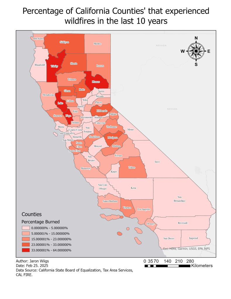

This was my capstone project for my Specialization in Fundamentals of GIS at the University of California Davis. I used 2 pieces of data; wildfire occurrences across California from 2012-2022, and California’s county borders. The rest of the information was processed by me using tools in ArcGIS pro.